Safety Rest Areas: Cherokee County Northbound
(Reconstructed opened December 2004)
|
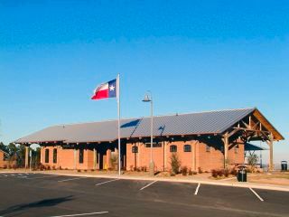 View of the front entrance of the newly reconstructed facility |

Location
|
Features
Miscellaneous
- Reconstructed facility opened December 2004. The new design is a tribute to the numerous tomato sheds that once lined up nearby railroad tracks distributing local grown tomatoes all over the country
- The site is on a scenic ridge 240 feet above the surrounding terrain with 30 to 35 mile views of a wide, pine tree covered valley below. The ridge is part of a long, flat-topped hill that extends for nine miles. A "Love's Lookout" historical marker is located on-site. The location is named after John Wesley Love, who in 1904 bought much of the surrounding area and planted a 600-acre peach orchard
- The county was named for the Cherokee Indians who lived in the area
- Nearby points of interest include Mission Tejas State Historical Park, Caddoan Mounds State Historic Site, Tyler State Park, Jim Hogg State Historic Park, and Fort Parker. The Texas State Railroad State Historical Park operates two antique trains on 25 scenic miles between depots in Rusk and Palestine